

MTR
Choose a station and exit
Central and Hong Kong stations are planning starting points. Individual exits were not surveyed here; no fixed walking time or universally best exit is promised. Check MTR information and current routes.
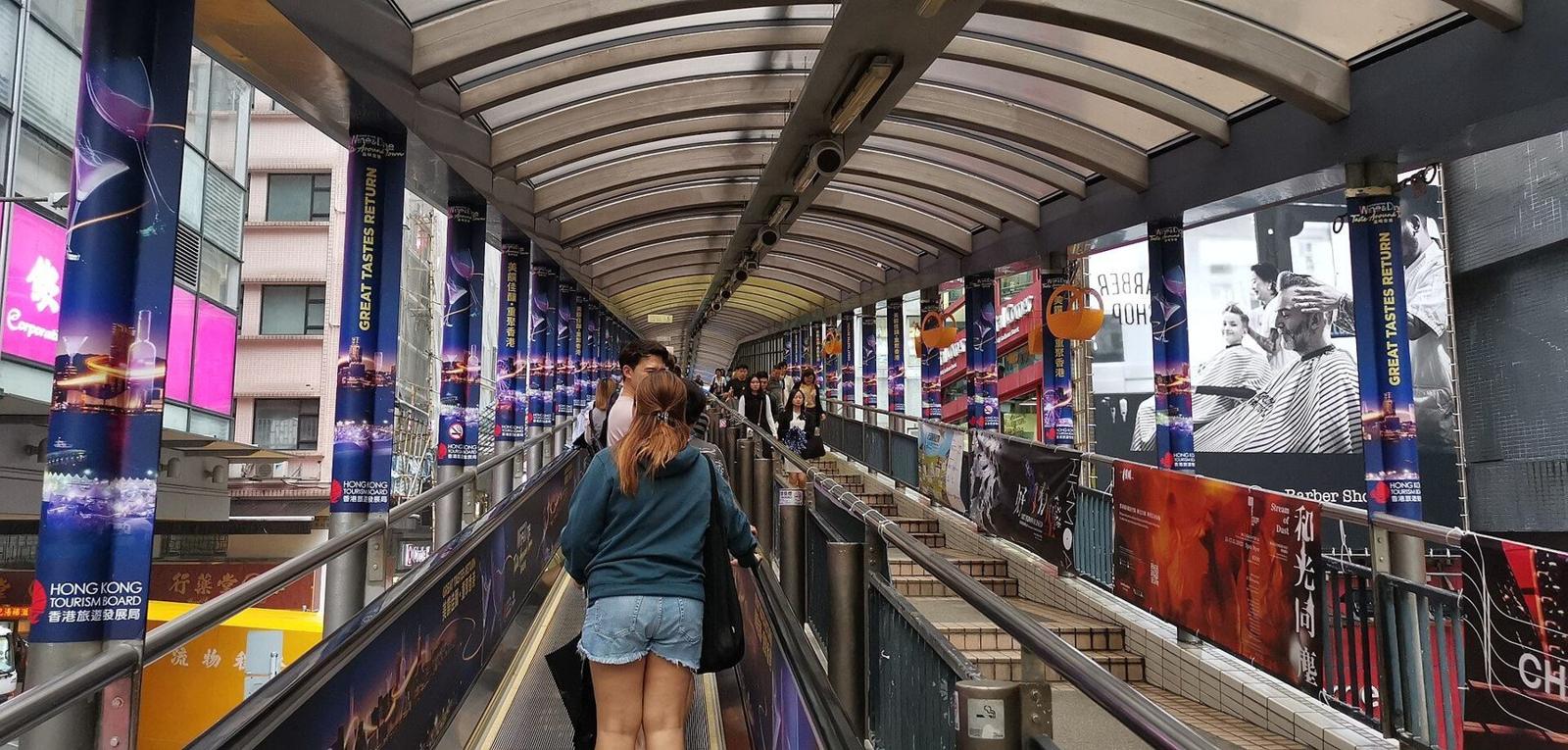
Central → Mid-Levels
A hillside pedestrian system of separate escalators, walkways and footbridges, rather than one continuous escalator. The Transport Department records its 1993 opening, Queen’s Road Central–Conduit Road route and EMSD management. It does not reach Victoria Peak.
Rated 4.1 on Google Maps from 10,641 reviews · Manual snapshot dated 2026-11-09; does not update automatically; not reviews collected here
Hero: cropped detail of escalator steps and handrails, photographed 2019-06-12; not today’s direction, current conditions or a verified entrance. Mx. Granger / Wikimedia Commons · CC0 1.0. Cropped, resized and recompressed.
Published system
16 escalators · 3 travelators
Downhill
06:00–10:00
Uphill start
10:00 / 10:20; see sources
Reviewed
2026-10-30
THE URBAN RIDE
Checked 2026-10-30: the Transport Department lists downhill 06:00–10:00 and uphill 10:00–midnight; the Tourism Board lists uphill 10:20–midnight. The official pages differ on the uphill start. This guide does not treat 10:00–10:20 as a verified system-wide shutdown; follow direction indicators, maintenance signs and management instructions.
01 / Lower section
The Tourism Board identifies Queen’s Road Central as the start, linking with the Central Market footbridge. The Maps Jubilee Street address is orientation, not a surveyed step-free entrance.
02 / Choose a stop
Use open exits only. Move clear of escalator landings before stopping for photos; keep routes clear and respect private homes. Separate venues have their own hours and entry terms.
03 / Upper section
Conduit Road is in the Mid-Levels, not Victoria Peak. Check separate Peak transport and ticket arrangements; do not assume a Peak Tram station is at the escalator endpoint.
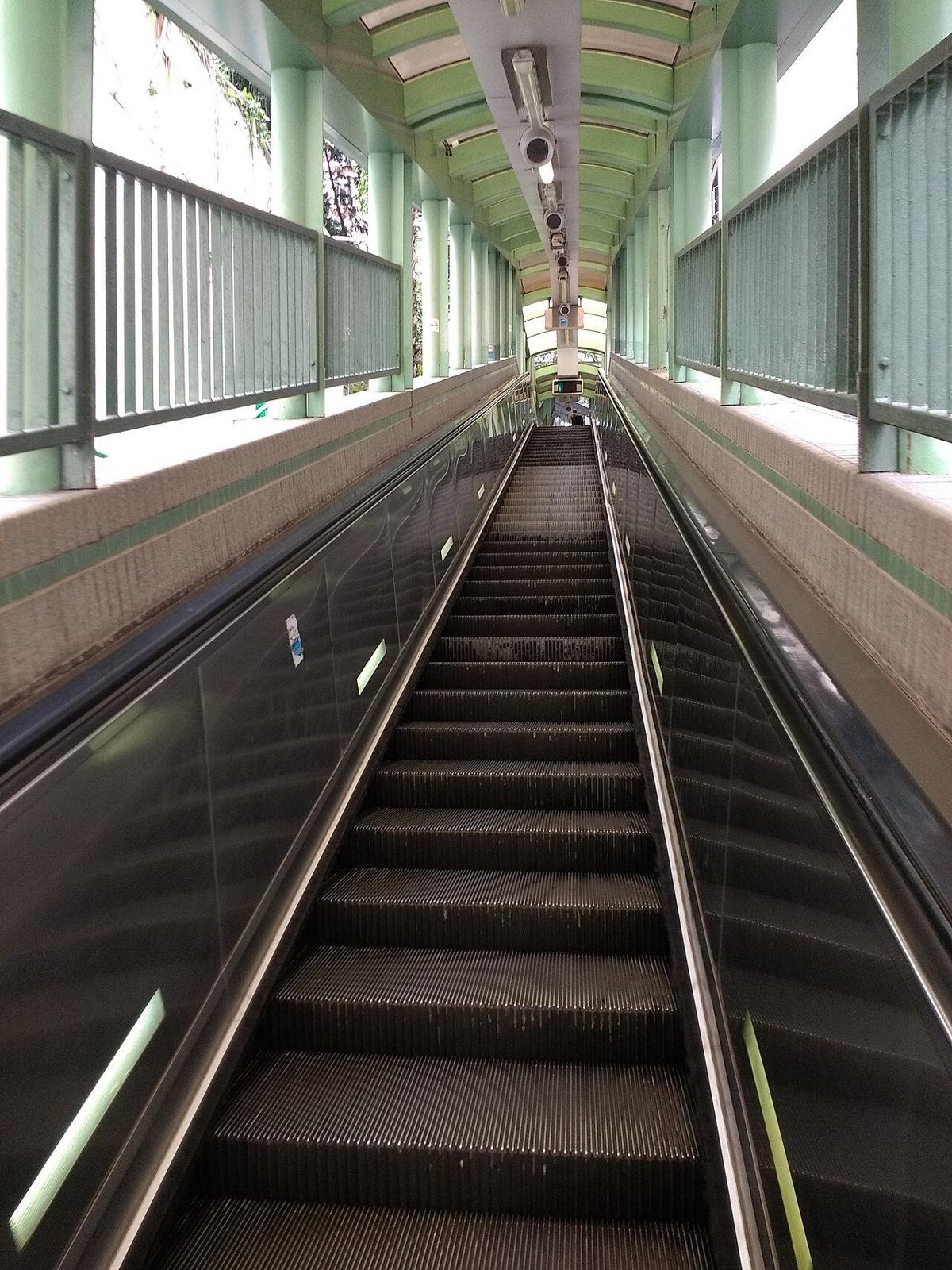
WHEN TO GO
Checked 2026-10-30: the Transport Department lists downhill 06:00–10:00 and uphill 10:00–midnight; the Tourism Board lists uphill 10:20–midnight. The official pages differ on the uphill start. This guide does not treat 10:00–10:20 as a verified system-wide shutdown; follow direction indicators, maintenance signs and management instructions.
This site has no live operating-status feed. One open segment does not establish availability elsewhere. Check posted alternatives for maintenance or closures; stairs are not a suitable fallback for everyone.
No universal end-to-end journey time was verified. Plan around crowds, stops, energy and return transport. A roof does not establish usability in severe weather.
GETTING THERE
Use the Transport Department’s HKeMobility planner to compare routes from your starting point to the street connection you choose. Check exits, walking distance and lift availability for the day.
MTR
Central and Hong Kong stations are planning starting points. Individual exits were not surveyed here; no fixed walking time or universally best exit is promised. Check MTR information and current routes.
Street connection
Connections between Queen’s Road Central and Conduit Road involve differing heights and streets. One Maps point is not the only entrance to the whole system and does not establish step-free access.
Return journey
The system reverses its one-way direction by time of day. An uphill ride does not mean a downhill escalator is available simultaneously. Plan suitable public transport or a street-level return route.
Ride and tickets
Public pedestrian system
The Tourism Board’s transport handbook describes the ride as fare-free. That does not cover food, exhibitions or separate transport. This site does not sell tickets.
Parking and connections
Check the day’s arrangements
Dedicated parking, live availability and tariffs were not verified. Check official transport and parking for your actual destination; a street landmark is not permission to stop or drop off.
Accessibility and pushchairs
Use suitable lifts, not escalators
EMSD safety guidance directs users with wheelchairs, pushchairs or bulky luggage to lifts rather than escalators. Streets and stairs along the system are not a continuous step-free route. Confirm suitable entrances, lifts and street-level alternatives; this review did not survey a complete accessible route.
EAT ALONG THE WAY
Choose a venue from its current directory before selecting an escalator exit. This review did not sample food or verify individual menus or queue times.
Directory
The operator maintains a shop and restaurant directory. Check the actual venue, floor and current hours; not every business necessarily has seats or opens at the same time.
Separate venue
Tai Kwun maintains its own dining and shopping information. It is not an escalator operating facility; check access, business hours and reservations separately.
Dietary requirements
Ask about allergies, vegetarian or halal requirements and accessible seating. A neighbourhood label or Maps rating does not establish suitability.
NEARBY
These are separate destinations to consider, not a surveyed ten-minute walking circle. Check opening, tickets and accessible entrances separately.
Revitalised building
The Tourism Board describes a Grade III historic building revitalised for dining, retail and cultural experiences. The lower footbridge connection does not make shop hours identical to escalator hours.
Heritage and art
A heritage and arts destination in the former Central Police Station compound. Its visitor page distinguishes site and exhibition arrangements; this guide does not repeat a blanket Monday-gallery closure claim.
Design and history
Government information describes the former Hollywood Road Police Married Quarters revitalised as PMQ, a creative and design destination. Check exhibitions, shops and transport separately; no fixed walking time is promised.
Explore individual locations with history, access, photos and a place-specific map. All links open guides on this site.
More nearby walks: Cat Street antique market →
TOPIC GUIDES
Each page answers one search question, grouped by access, direction, history, nearby places, food and itineraries. Check official notices and on-site signs for maintenance, hours and venues.
Each in Traditional Chinese and English
Work out where to join the system, where to leave it, and how the current direction affects your plan.
Why the hillside system was built, how it works, and how the experience changes through the day.
Historic buildings, markets and neighbourhoods reachable from different sections of the route.
Plan meals and breaks by street and type, without unverified venue names, prices or hours.
From a short stop to a half day, each route has its own stops, order and return plan.
Families, where to stay, and the full set of common visitor questions.
Each in Traditional Chinese and English
48 / 48 · This page summarises public information and is not a live operating status. Check Transport Department notices and on-site direction signs before travelling.
MAP
Maps lists Jubilee Street for orientation, while the official route runs from Queen’s Road Central to Conduit Road. The point is not a verified entrance; the former coordinate and Plus Code were not surveyed here.
FAQ
Checked 2026-10-30: the Transport Department lists downhill 06:00–10:00 and uphill 10:00–midnight; the Tourism Board lists uphill 10:20–midnight. The official pages differ on the uphill start. This guide does not treat 10:00–10:20 as a verified system-wide shutdown; follow direction indicators, maintenance signs and management instructions.
No. The Tourism Board explicitly identifies Conduit Road as the endpoint, not Victoria Peak. Check separate Peak transport; the escalator is not the Peak Tram.
The Transport Department’s introduction identifies EMSD as the current manager. This is an independent, unofficial, nonprofit tourism and educational guide and does not represent management.
EMSD safety guidance directs users with wheelchairs, pushchairs or bulky luggage to lifts rather than escalators. Streets and stairs along the system are not a continuous step-free route. Confirm suitable entrances, lifts and street-level alternatives; this review did not survey a complete accessible route.
The reviewed sources do not establish a fixed system-wide shutdown interval. The Transport Department and Tourism Board list differing uphill starts; follow actual indicators and notices for each section.
No. The 4.1 rating and 10,641 reviews are a snapshot dated 2026-11-09, not reviews collected here. Maps showing midnight closure did not verify live availability of the whole system.
Reviewed on 2026-10-30, not live operating monitoring. Recheck maintenance and direction signs and consult Hong Kong Observatory warnings for severe weather. A general timetable does not establish current safety or availability.
Main sources reviewed 2026-10-30; additional public links added 2026-11-09 without re-verifying live operations. Sources cover different places and services. Live operation, universal walking times, menus and complete accessible routes were not verified. This site has no live weather or whole-system monitoring.